-
-
-
AIRCRAFT
-
Product Name
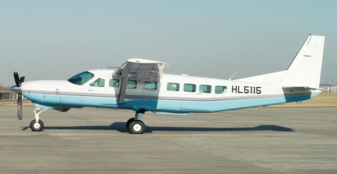
CESSNA 208B CARAVAN -
Manufacturer
CESSNA AIRCRAFT -
Type
Landplane -
Size(m)
- ·
Width : 15.8
- ·
Length : 11.4
- ·
Height : 4.5
- ·
-
Performance
- ·
Maximum Flight Altitude : 25,000ft
- ·
Maximum Speed : 175knots
- ·
Take off Weight : 8,000lbs
- ·
Maximum Flight Range : 1,085NM (at 10,000 ft)
- ·
Maximum Flight Time : 7.0h (at 10,000ft)
- ·
-
Application
- ·
Digital Aerial Surveying
- ·
Aerial LiDAR Surveying
- ·
-
-
-
-
-
MMS
-
Product Name
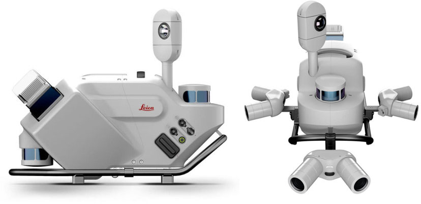
Pegasus TRK700 Neo -
Manufacturer
Leica Geosystem -
Scanner
- ·
Maximum pulse rate : 2 X 500kHz
- ·
Maximum rotational speed 2 X 250Hz
- ·
-
Camera
- ·
Type : 360° Panorama
- ·
Focal length : 3.3mm
- ·
Calibration : Permanent
- ·
-
Size(cm)
70 X 33 X 56 -
Application
- ·
Precise road map production
- ·
Cross-sectional surveying of a road
- ·
Road Facility Data-Base Construction
- ·
-
-
-
-
-
GNSS
-
Product Name
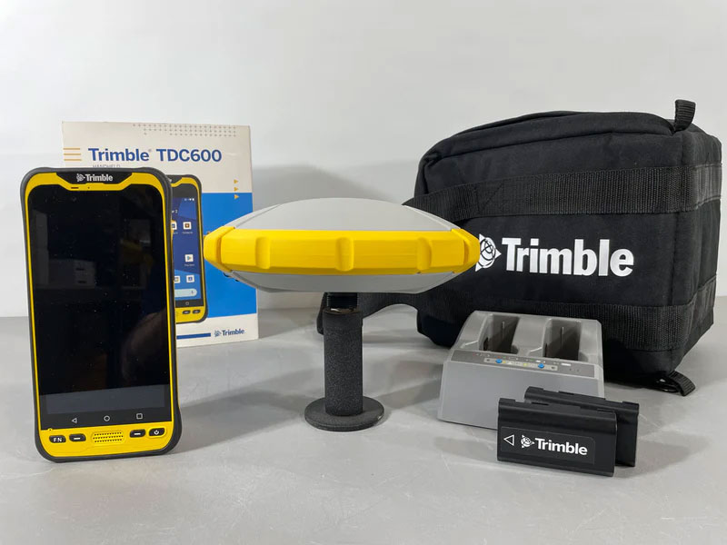
Trimble R4s -
Manufacturer
Trimble -
channel
240 Channel -
Static
- ·
Horizontal Accuracy : 3mm + 0.1ppm
- ·
Vertical Accuracy : 3.5mm + 0.4ppm
- ·
-
VRS
- ·
Horizontal Accuracy : 8mm + 1ppm
- ·
Vertical Accuracy : 15mm + 1ppm
- ·
-
Application
- ·
Acquire 3D Location Information
- ·
Various Reference Point Survey
- ·
-
-
-
-
-
Total Station
-
Product Name
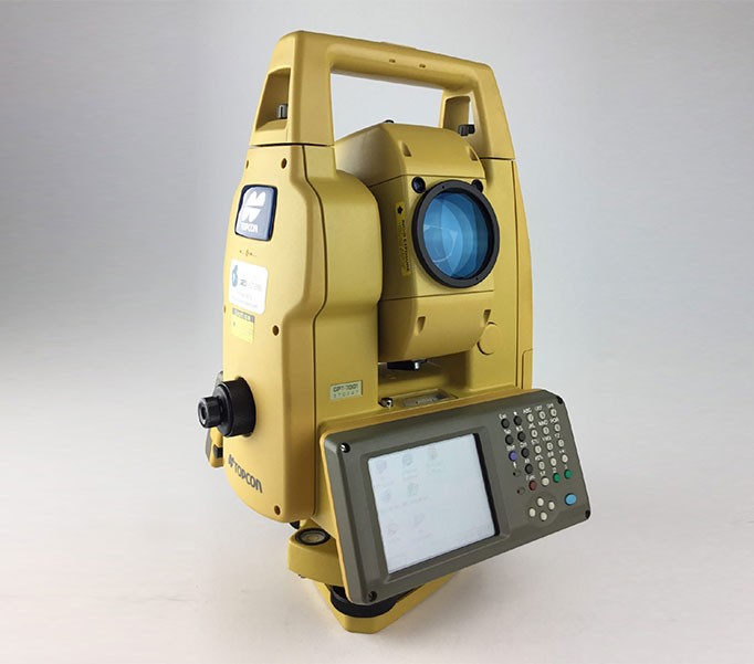
GPT-7001 -
Manufacturer
TOPCON -
magnification
30X -
Lens Diameter
45mm -
Measuring time
- ·
Precision Measurement: 1mm/1.2s
- ·
Course Measurement : 1mm/0.5s
- ·
Tracking Measurement : 1mm/0.3s
- ·
-
Application
- ·
3D Measurements of the Perimeter, Height, and Location of a Building
- ·
Measurement of the Location of Land
- ·
Measurement of the Elevation and Slope of the Terrain
- ·
-
-
-
-
-
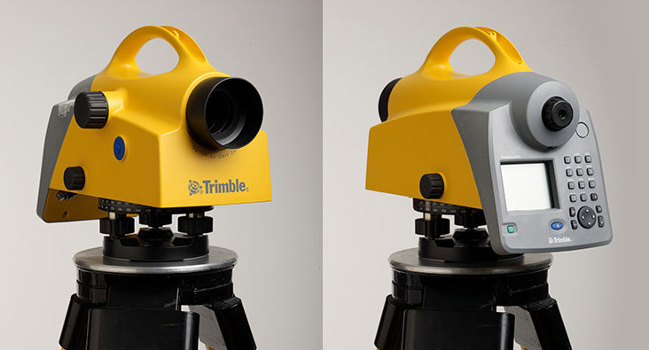
Digital Level
-
Product Name
Trimble DiNi 0.3 -
Manufacturer
Trimble -
Height Accuracy
- ·
Precision Stuff : 0.3mm
- ·
Standard Stuff : 1.0mm
- ·
-
Measurement time
3s -
Accuracy
±0.2“ -
Application
Gather elevation information with Level Measurements
-
-
-
-

-
Digital Mapping Camera
-
Product Name
DMCⅢ -
Manufacturer
Leica Geosystems -
Image Size(pixel)
14,592 X 25,728 -
Pixel size(μm)
3.9 -
Field of View (Cross/Along)
57.2°/34.4° -
Application
- ·
Aerial Photography
- ·
Aerial Photography Reading
- ·
Production of Image Maps and Image Cadastral Maps
- ·
-
-
-
-

-
Aerial LiDAR
-
Product Name
CityMapper -
Manufacturer
Leica Geosystems -
PULSE RATE
0 ~ 150Khz -
Operational Altitude
200m ~ 6000m AGL -
Field of View
75° -
Application
- ·
Production of DEM/DSM 3D High-Precision Data
- ·
Utilize 3D Digital-Twin and SmartCity Deployments
- ·
-
-
-
-
-
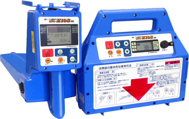
Metal Pipe Locator
-
Product Name
MPL-H10S -
Manufacturer
TAKACHIHO SANGYO -
Application
- ·
Accurate Location Detection of Metal Gas Pipes, Water Pipes, Heating Pipes, Etc. Buried Underground
- ·
Use for Maintenance and Restoration After Locating Metal Sewers and Drain Pipes
- ·
-
-
-
-
-
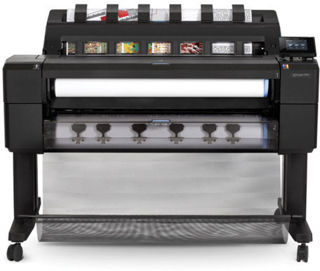
Plotter
-
Product Name
HP DesignJet T1530 -
Manufacturer
HP -
Print resolution
Up to 2400 x 1200 optimized dpi -
Line Accuracy
± 0.1% -
Minimum line width
0.02 mm -
Application
- ·
Output Image Maps and Cadastral Maps
- ·
Output Various Digital and Map Drawings
- ·
-
-
-
-
-
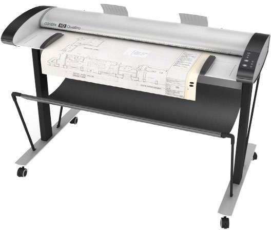
Scanner
-
Product Name
IQ Quattro -
Manufacturer
Contex -
Optical resolution
1200dpi -
Maximum resolution
8600dpi -
Total number of pixels
64800 pixels -
Accuracy
0.1%±1pixel -
Application
- ·
Scan Image Maps and Cadastral Maps
- ·
Scan Various Digital Map and Design Drawings
- ·
-
-
-
-
-
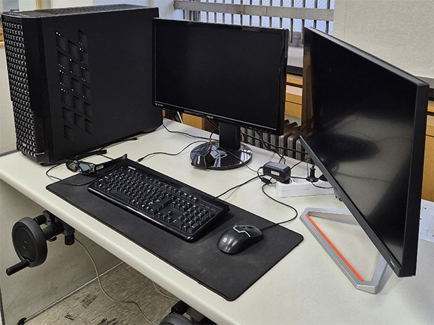
Drafting Machine
-
Hardware Configuration
- ·
Workstation
- ·
Stereo Monitor
- ·
General Monitor
- ·
Hand Wheel
- ·
Foot Pedal
- ·
Drum
- ·
-
Software
Geo3Di 3.0 -
Application
- ·
Photographic Reference Point Measurement of Aerial Surveying Images
- ·
Construction and Updating a Digital Topographic Map
- ·
Construction and Updateting a 3D spatial information
- ·
-
-