-
-
First Aero Survey Co., Ltd. has the best technology and equipment to secure high-quality performance, and based on this, it provides an optimal database through the process of processing and editing raw data by manual and automatic input/output systems.
-
Q UALITY
A more accurate ICT-based high precision digital map
with a scale finer than 1:1,000 is needed. -
-
Making a Digital Topographic Map
A map that accurately embodies the boundaries, forms, information, etc. of space
-
Accurately and quickly implement space boundaries, shapes, information, etc. through professional drawing equipment and production automation. Various topics such as road and traffic safety facilities, water supply and sewage facilities, and urban development plans are also used as production base data. Experience and know-how in mapping various fields such as cadastral maps, smart farm maps, and real-time safety maps are provided
Self-Developed the Latest 3D Digital drawing S/W XDStereo efficiently builds digital topography with new drawing technologies Aerial Photo Digital Mapping, Digital Mapping Based on 3D Point Cloud, Support for Aerial Photo Stereo Viewer, Support for RED/BLUE Mode, Support for Polarized 3D Monitor Function, Support for File Formats such as LAS, SHP, DXF
-
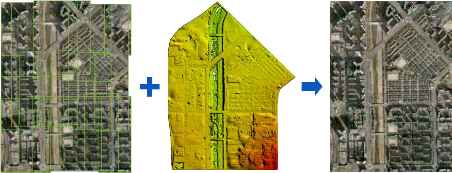
Orthophoto Generation
Intuitive image information corrected for aerial photographic distortion
-
Image information corrected for distortion (object, topography, etc.) of aerial photographs
various ways, such as on-site investigation, calculation of publicly announced land prices, and national land management